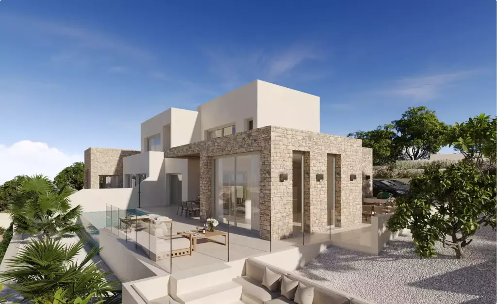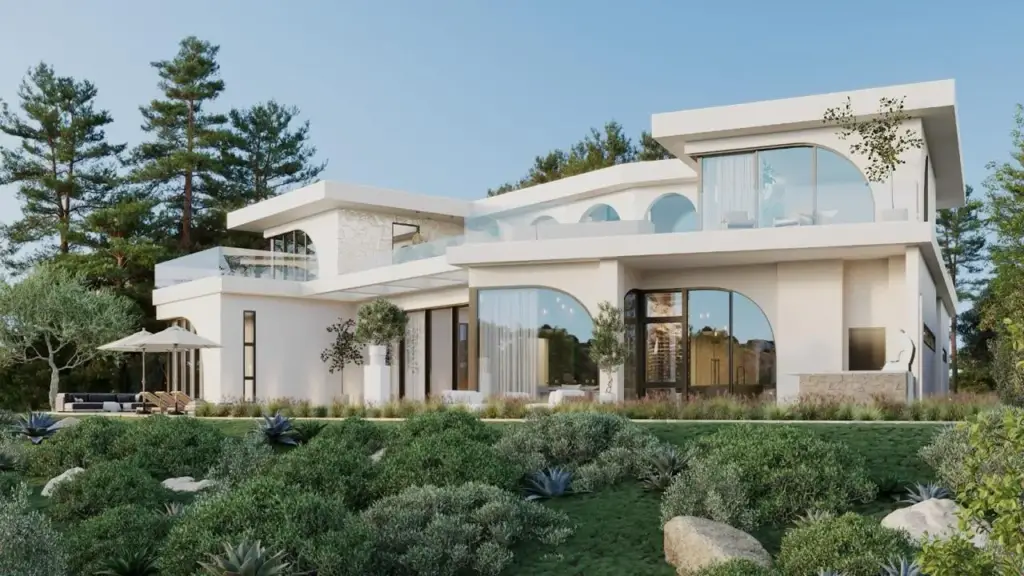
Aerial rendering for real estate is a 3D visualization that shows a property from above — a bird's-eye or oblique view of the building, its plot, and the surrounding neighborhood — created in CGI rather than photographed. Developers use it to market projects that a drone cannot shoot yet: unbuilt developments, phased construction, and master-planned communities. It answers the one question a ground-level render never can — how does this property sit in its context?
What an aerial real estate render shows buyersWhat an aerial real estate render shows buyers
An aerial render pulls the camera above the roofline so the whole site reads at once: massing, roof design, parking, landscaping, road access, and how the building relates to its neighbors, water, or skyline. For a buyer or investor, that context is the decision. A street-level render sells a façade; an aerial render sells a location.
Because it is computer-generated, an aerial render is not limited to what exists today. It can place an unbuilt tower into a real city block, show a suburban development with mature trees on day one, or reveal a resort's beachfront layout years before the first foundation is poured. That is the practical edge over aerial photography — you are not waiting for the building to exist.
Aerial rendering vs drone photography: which fits your propertyAerial rendering vs drone photography: which fits your property
Drone photography captures a property that already stands. Aerial rendering builds one that does not — or shows an existing one changed. The two are often confused because both deliver an overhead shot, but they solve opposite problems, and the right choice depends entirely on whether your project is built.
| Factor | Drone photography | Aerial rendering (CGI) |
| Property status | Must be built | Built or unbuilt |
| Best for | Existing homes, completed developments | Pre-sales, phased builds, master plans |
| Control over scene | Weather, season, and site as-is | Full control — light, season, landscaping, traffic |
| Shows future changes | No | Yes — proposed towers, roads, amenities |
| Typical turnaround | Days (permitting, flight) | 1–3 weeks per view |
The strongest real estate marketing often combines both: a drone plate for a real, existing context, with CGI compositing the unbuilt building into it. That hybrid is where aerial rendering earns its keep for developments rising inside established neighborhoods.
Real estate projects where aerial rendering earns its costReal estate projects where aerial rendering earns its cost
Aerial rendering is not for every listing. It pays off when the value of a property lives in its context or its future state — not its front door. These are the scenarios where developers reliably see it move deposits:
- Master-planned communities — buyers need to see how homes, parks, schools, and roads knit together across dozens of acres.
- Mixed-use and mid-rise developments — the pitch is the relationship between retail, residential, and public space, which only reads from above.
- Waterfront and view properties — an aerial angle proves the sightline to the ocean, lake, or skyline that justifies the price.
- Phased construction — sell Phase 2 while Phase 1 is still a crane site by rendering the finished whole.
- Resorts and hospitality — layout of pools, villas, golf, and beach access is the product, and it is inherently a top-down story.
- Industrial and commercial sites — warehouses, logistics parks, and business campuses sell on footprint, access, and expansion room.
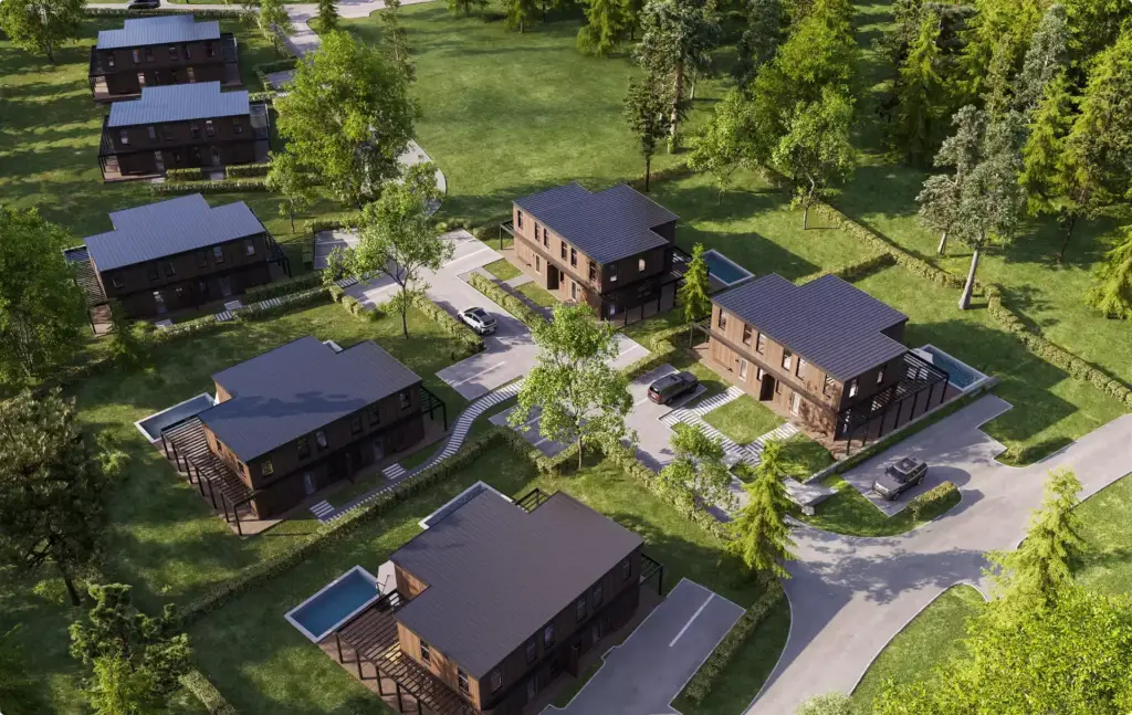
For a single completed house with no surrounding story to tell, a drone photo is cheaper and enough. The aerial render is a tool for context and for the not-yet-built.
Types of aerial real estate rendersTypes of aerial real estate renders
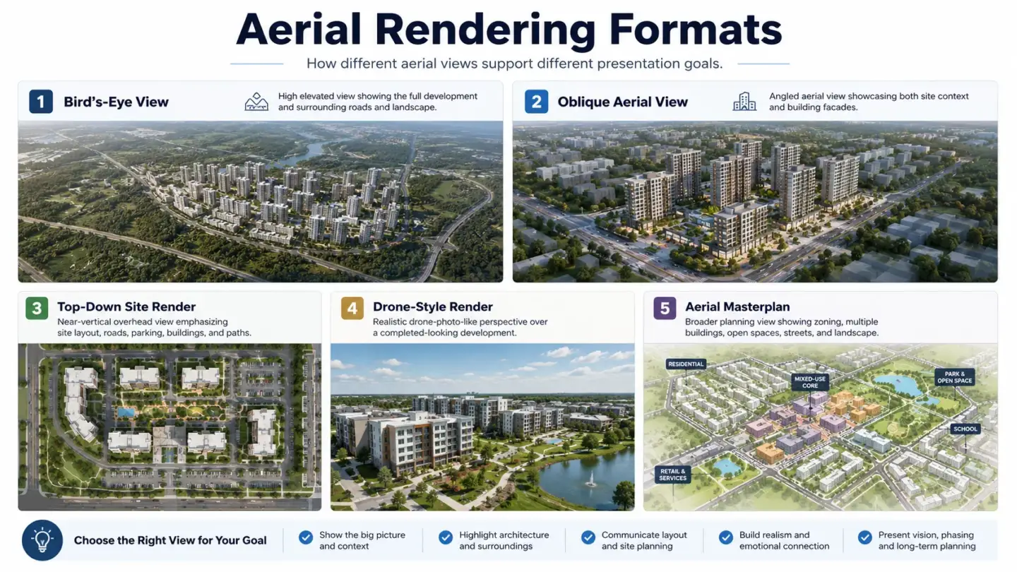
"Aerial" covers several camera heights and angles, each answering a different marketing question. Choosing the right one is a framing decision, not a technical one.
- Bird's-eye (top-down) view — near-vertical angle, best for site plans, community layouts, and showing plot boundaries.
- Oblique (three-quarter) aerial — the workhorse of real estate marketing; high enough for context, angled enough to show building faces and rooflines.
- Low aerial / drone-height view — just above the treeline, cinematic, sells the arrival experience and immediate surroundings.
- Aerial site plan render — a stylized top-down map with labeled zones, phases, or lots, used in sales centers and brochures.
- Aerial masterplan render — the widest view, taking in an entire development and its connection to the wider area.
How much aerial rendering costs for real estate
Aerial rendering for real estate typically costs $500 to $3,000 per still image in 2026, with most marketing-grade oblique views landing around $900–$1,800. Wide master-plan renders with heavy landscaping, many buildings, and real-context compositing sit at the top of that range; simpler top-down site plans sit at the bottom. Prices are industry estimates and vary by studio, scene complexity, and resolution.
| Render type | Typical price range (per still) | Main cost driver |
| Aerial site plan (top-down) | $500–$1,000 | Number of labeled zones/lots |
| Oblique aerial, single building | $800–$1,800 | Building detail, landscaping |
| Masterplan / community aerial | $1,500–$3,000+ | Scene scale, context compositing |
Three things move the number most: how much of the surrounding context has to be modeled or composited, the output resolution (billboard and print push it up), and how many revision rounds you build in. Getting reference — survey data, drone plates, material specs — to the studio up front is the cheapest way to keep it controlled.
How an aerial real estate render gets madeHow an aerial real estate render gets made
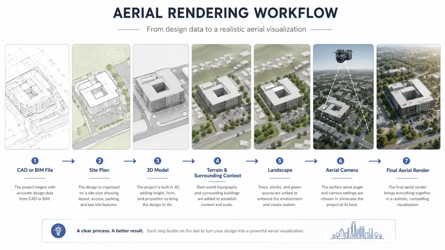
The workflow is short but each step decides whether the final image reads as believable from above, where mistakes are hardest to hide.
- Gather reference — architectural drawings, site survey, and, where the project sits in a real neighborhood, a drone plate of the actual context.
- Model the building and site — massing, façades, roofscape, roads, and landscaping built to scale in 3D.
- Set the aerial camera — pick the height and angle that tells the marketing story, matching the drone plate's lens if compositing.
- Light and add context — sun angle, season, cars, people, and vegetation to make the scene feel lived-in.
- Render and composite — the CGI building is blended onto the real aerial plate, matching perspective, light, and haze.
- Post-production — color, atmosphere, and final retouching for print or web resolution.
In our studio, the detail that most often separates a convincing aerial composite from an obvious one is matching the sun. We render the CGI building to the exact time-of-day and sun angle of the drone plate, so shadows across the site fall the same direction as the real trees and neighboring roofs. Get that wrong and the eye catches it instantly, even if it cannot say why.
Studios that specialize in this — including our own aerial rendering services — treat the context plate as seriously as the building, because from above the surroundings are half the image. For projects where the arrival and façade matter as much as the overview, aerial views are usually paired with ground-level 3D exterior rendering in the same marketing set.