A site plan rendering is a to-scale, colored or photorealistic visual of an entire property — its buildings, landscaping, roads, parking and boundaries — seen from above. It turns a flat CAD site plan into an image a buyer, investor or zoning board can read at a glance, long before construction starts.
This guide covers what a site plan rendering is, the 2D, 3D and AI methods behind it, what each one costs, when you actually need one, and how it differs from a floor plan or an aerial render.
What is site plan rendering?What is site plan rendering?
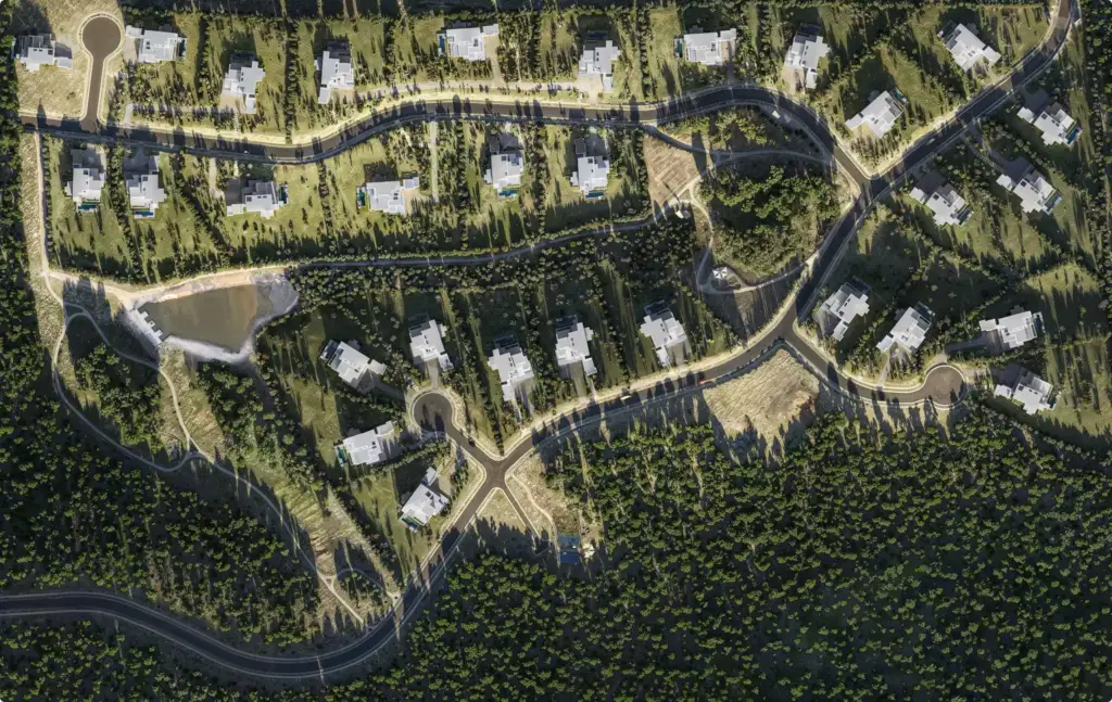
Site plan rendering is the process of turning a technical site plan — the top-down, survey-based drawing of a property — into a clear, colored or photorealistic visual. The underlying plan shows building footprints, setbacks, property lines, driveways, parking, walkways and landscaping zones. On its own, that drawing is accurate but hard for a non-architect to read.
Rendering adds the missing layer: real materials, greenery, shadows, vehicles and surrounding context. The result still reads as a plan — you are looking straight down or at a slight tilt — but it communicates the finished development to clients, investors and approval boards who do not think in CAD linework.
2D colored site plans vs 3D site plan rendering2D colored site plans vs 3D site plan rendering
There are three common ways to render a site plan, and the right one depends on your stage, budget and audience. A flat 2D colored plan is the fastest and reads cleanly for permits. A 3D site plan render adds depth, lighting and realism for sales and investor decks. AI tools sit in between for quick concepts.
| Method | Best for | Look | Relative cost |
| 2D colored site plan | Permits, zoning, clean presentation | Flat top-down, colored zones | Lowest |
| 3D site plan / masterplan render | Sales, investor pitches, marketing | Photorealistic, depth and shadows | Highest |
| AI-generated site plan | Early concepts, mood, ideation | Realistic but not to-scale | Low |
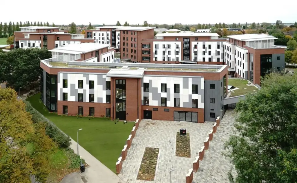
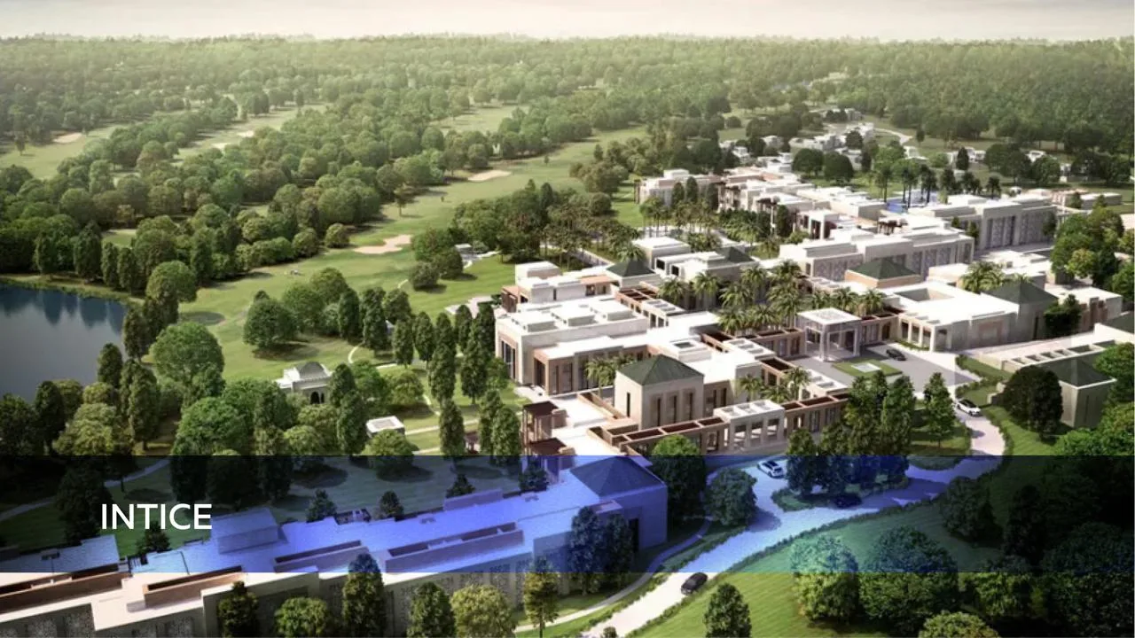
One distinction matters here: if you need a photorealistic bird’s-eye perspective of the buildings themselves rather than a top-down plan, that is aerial rendering — a related but separate deliverable.
AI site plan rendering: where it fits and where it doesn’t
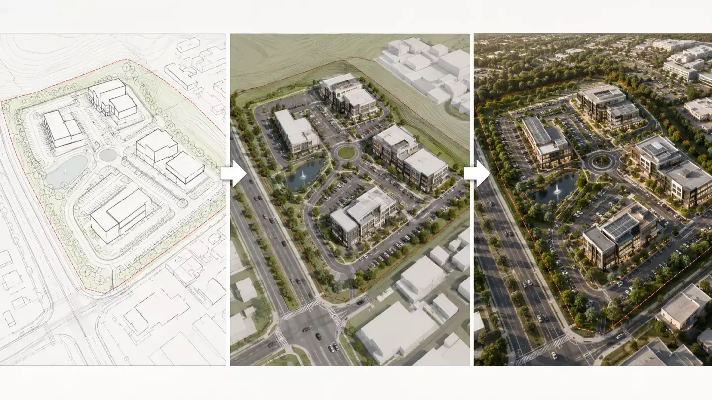
AI site plan tools let you upload a 2D CAD plan or sketch and generate a colored or aerial-style visual from a text prompt in minutes. For early concepts, mood boards and quick investor teasers, that speed is genuinely useful.
The limits show up fast on real projects. AI struggles to stay true to scale, invents landscaping and building details that do not match the survey, and rarely produces a submission-grade plan a zoning board will accept. For anything that has to be accurate or sales-final, AI is a starting point, not the finished deliverable.
What a rendered site plan showsWhat a rendered site plan shows
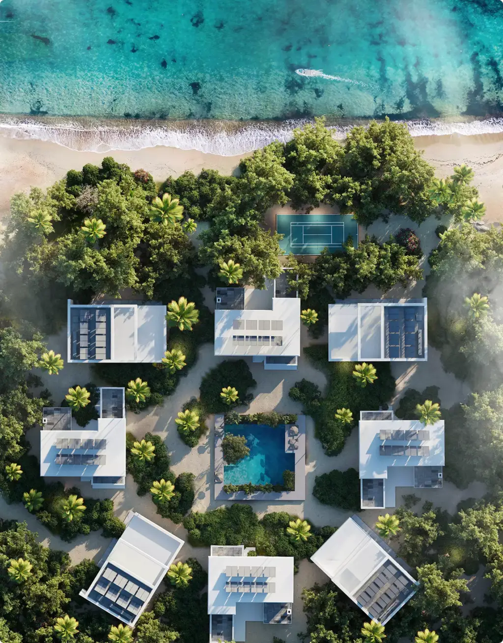
A good site plan rendering makes every element of the property legible at a glance. Typically it includes:
- Building footprints and roof layouts
- Property lines, setbacks and zoning boundaries
- Roads, driveways, parking and circulation paths
- Landscaping — lawns, trees, planting beds and water features
- Amenities such as pools, courtyards, playgrounds and plazas
- Surrounding context: neighboring lots, streets and terrain
When you need a rendered site plan
A site plan render earns its cost at a few specific moments in a project:
- Zoning and permit submissions — a colored plan helps boards understand layout, density and green space.
- Investor and stakeholder pitches — a clear visual sells the vision faster than linework.
- Real estate and pre-sales marketing — buyers see the whole community before a single foundation is poured.
- HOA and community approvals — neighbors grasp how a development fits its surroundings.
From our studio — A bare building outline doesn’t sell. What sells is the context around it: the landscaping, the cars, the light and shadows, the neighboring buildings. A cheap flat plan with no surroundings can sink an expensive project.
Dim Kuzmenko, Maverick Frame
How much does site plan rendering cost?
Most site plan renders fall between $300 and $1,000 for a single image, with large multi-building masterplans climbing to several thousand dollars as the scene, detail and number of viewpoints grow. A flat 2D colored plan sits at the low end; a photorealistic 3D masterplan sits at the top.
Price scales with site size, level of landscaping detail, number of revisions and turnaround speed. For a full breakdown of how rendering is priced, see our 3D rendering pricing guide.
Site plan rendering vs floor plan vs aerial renderingSite plan rendering vs floor plan vs aerial rendering
These three get mixed up constantly, but they answer different questions. A site plan shows the whole property from above; a floor plan shows the interior layout of a building; an aerial render shows the buildings in 3D from an elevated angle.
| Type | What it shows | Viewpoint | Main use |
| Site plan rendering | Entire lot: buildings, landscaping, circulation | Top-down or slight tilt | Zoning, masterplan marketing |
| Floor plan rendering | Interior layout of one building | Top-down cutaway | Unit sales, space planning |
| Aerial rendering | Buildings in their context | Elevated 3D angle | Hero shots, bird’s-eye marketing |
If your goal is the inside of a building rather than the grounds, you want floor plan rendering instead.
How a professional site plan rendering is madeFrom our studio — Clients call everything “aerial” and mix up site plans, floor plans and master plans all the time. The first call is almost always about re-scoping what they actually need to show.
Dim Kuzmenko, Maverick Frame
How a professional site plan rendering is made
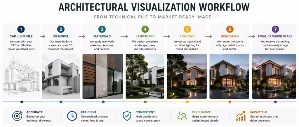
A studio-grade site plan render follows a clear sequence:
- Intake — we start from your CAD site plan, survey or sketch to lock exact boundaries and scale.
- Zoning the areas — buildings, roads, parking and green space are separated into clean layers.
- Landscaping and context — trees, planting, water, vehicles and neighboring structures are added for realism.
- Lighting and materials — textures, shadows and time-of-day lighting give the plan depth.
- Review and revisions — you check accuracy and presentation before final delivery.
For large developments, a site plan render often pairs with exterior rendering of individual buildings, giving the masterplan both the wide view and the ground-level detail.

Turn Ideas Into Visual Stories
FAQ about site plan rendering
What is a rendered site plan?
A rendered site plan is a colored or photorealistic version of a property’s top-down site plan, showing buildings, landscaping, roads and boundaries. It makes a technical CAD drawing easy for buyers, investors and zoning boards to understand before construction begins.
What does it mean to render a site plan?
Rendering a site plan means adding color, materials, landscaping, shadows and context to a flat technical drawing. The plan stays to-scale and top-down, but becomes a clear visual instead of linework that anyone can read, not just architects.
Can AI or ChatGPT create site plan renderings?
AI tools can generate quick site plan visuals from a sketch or CAD file, which helps at the concept stage. They struggle with scale accuracy and realistic landscaping, so they rarely produce a submission-grade or sales-final result on their own.
How much does a site plan rendering cost?
Most site plan renders cost between $300 and $1,000 for a single image. Large multi-building masterplans can reach several thousand dollars, depending on site size, landscaping detail, number of viewpoints and how fast you need it delivered.
What software is used for site plan rendering?
Flat 2D colored plans are usually made in Photoshop and Illustrator over CAD linework. Photorealistic 3D site plans use tools like 3ds Max, V-Ray, Corona, Lumion or D5 Render, chosen for the level of realism and scale a project needs.
How long does a site plan rendering take?
A simple 2D colored site plan can be ready in a few days. A photorealistic 3D masterplan render typically takes one to two weeks, scaling with the size of the development, level of detail and number of revision rounds.