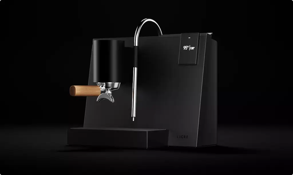
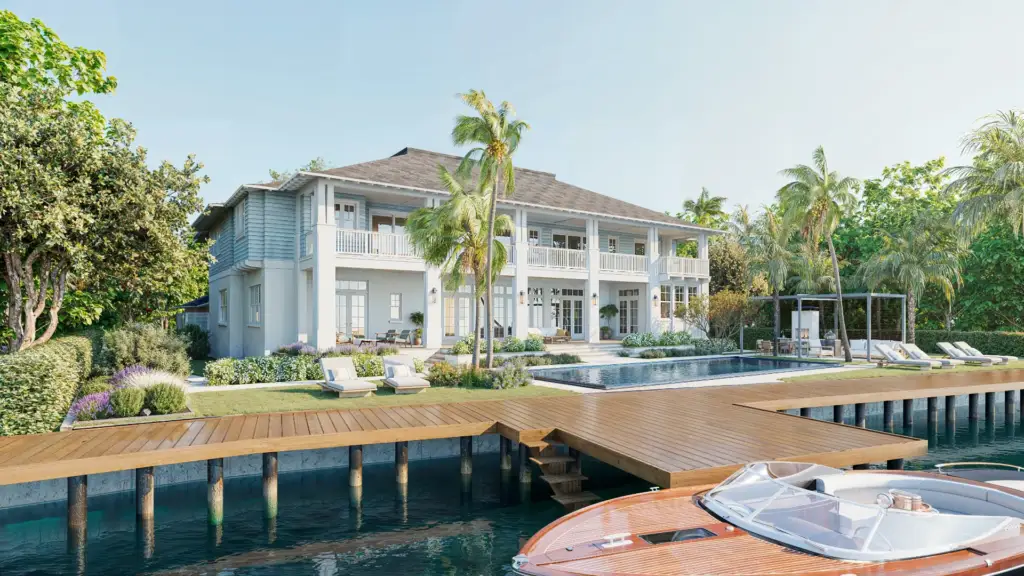
Landscape rendering is the process of creating visual images of outdoor spaces before they are built, redesigned, approved, or marketed. It turns site plans, sketches, CAD files, or 3D models into clear visuals that show planting, hardscape, lighting, terrain, materials, water features, furniture, and how people may use the space. Landscape rendering helps landscape architects, developers, homeowners, and public-space teams communicate gardens, parks, yards, streetscapes, and outdoor amenities through 2D views, 3D views, photorealistic visualization, animation, or interactive presentation.
Landscape Rendering MeaningLandscape Rendering Meaning
Landscape rendering is a visual representation of an outdoor design that helps people understand how a landscape will look, function, and feel before it is built. It can be a hand-drawn illustration, 2D digital plan, 3D model, photorealistic still image, animation, or interactive visualization. The purpose is to make planting, hardscape, lighting, terrain, and outdoor experience easier to evaluate.
A landscape render can show a private garden, residential yard, resort terrace, commercial plaza, park, rooftop amenity, or public realm improvement. It translates site plans and design decisions into visuals that clients, buyers, investors, and approval teams can understand without interpreting technical drawings. For outdoor projects that need realistic presentation, landscape rendering services can turn site information, planting concepts, and material references into market-ready visualizations.
Landscape rendering is useful because outdoor spaces often combine many layers. Trees, paving, furniture, lighting, slopes, water, and seasonal atmosphere all affect how the final space will feel. A clear render lets teams see those relationships before construction begins.
What a Landscape Rendering Shows
A landscape rendering shows the planned outdoor environment, including natural elements and built elements. It can communicate layout, scale, material choices, planting density, access, mood, and how people may use the space. The exact level of detail depends on the project stage and the audience.
- Trees, shrubs, lawns, and planting schemes.
- Paths, patios, plazas, driveways, and paving.
- Pools, ponds, fountains, and water features.
- Outdoor furniture, lighting, pergolas, and structures.
- Terrain, grading, slopes, and site context.
- People, vehicles, shadows, weather, and seasonal atmosphere.
A conceptual render may only need broad planting zones and simple pathways. A photorealistic render may need accurate plant species, paving texture, lighting, furniture, and surrounding architecture. A planning visual may also need labels, circulation routes, or context to explain how the landscape connects with the site.
Why Landscape Rendering Is Useful Before Construction
Landscape rendering is useful before construction because it helps clients and stakeholders see the design before money is spent on building it. Outdoor drawings can explain dimensions and zones, but they may not communicate atmosphere or real-world scale. A render makes decisions about planting, materials, paths, lighting, and furniture easier to discuss.
This reduces misunderstandings during approval and construction planning. A homeowner can see whether a patio feels too narrow, while a developer can test whether an amenity courtyard looks valuable enough for marketing. A public stakeholder can understand how a plaza, park, or streetscape may function before physical work begins.
How Landscape Rendering Works
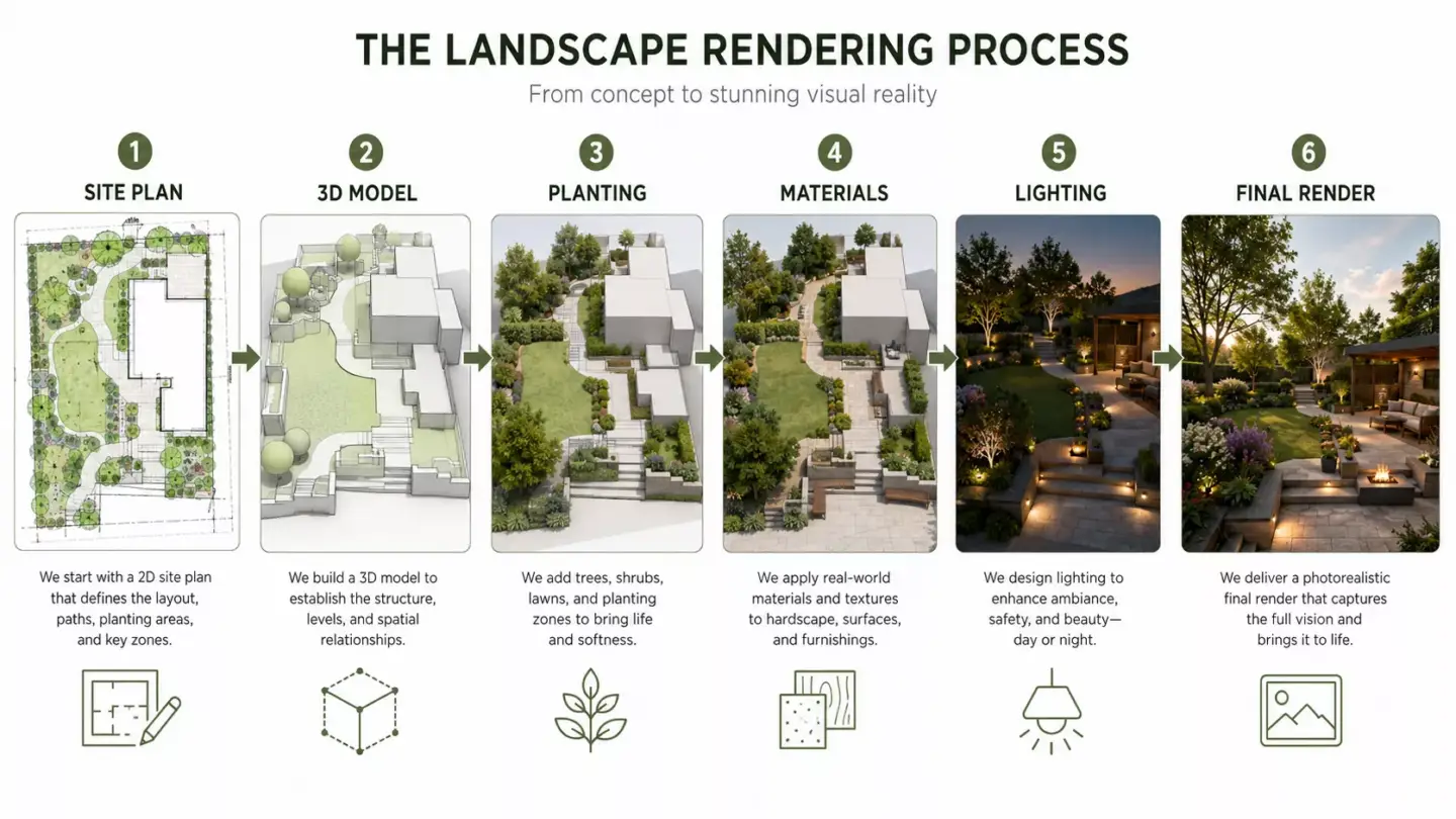
Landscape rendering works by converting design information into a visual image or model of the future outdoor space. The process usually starts with a brief, site data, and design references, then moves into layout, modeling, planting, materials, lighting, and post-production. The final output can be a simple 2D view, a realistic 3D image, an animation, or an interactive experience.
- Project brief: define the purpose, audience, style, level of realism, and required views.
- Site information: collect surveys, photos, CAD files, sketches, plans, references, and material notes.
- Base model or layout: create the site plan, terrain, buildings, paths, and major outdoor zones.
- Planting and hardscape: add trees, shrubs, grass, paving, walls, furniture, water, and lighting.
- Camera and composition: choose views that explain the design clearly.
- Lighting and atmosphere: set sunlight, shadows, season, time of day, and mood.
- Rendering and post-production: generate the final image and refine color, contrast, people, labels, or branding.
The quality of the source information strongly affects the result. A render based on accurate site plans, terrain data, and material references will usually be more reliable than one built from vague inspiration images. If buildings, site edges, or surrounding context also need to be modeled, architectural 3D modeling services can support the base geometry before final landscape visualization begins.
Main Types of Landscape Renderings
The main types of landscape renderings are 2D landscape renderings, 3D landscape renderings, photorealistic renderings, conceptual illustrations, animations, and interactive visualizations. Each type serves a different purpose in design, approval, marketing, or stakeholder communication. Not every project needs photorealism because early concepts often need clarity more than cinematic finish.
- 2D landscape rendering: a top-down or plan-based view that shows layout, zones, planting, and paths.
- 3D landscape rendering: a perspective view that shows depth, scale, materials, and spatial relationships.
- Photorealistic landscape rendering: a realistic image used for client approval, marketing, or investor presentations.
- Conceptual rendering: a faster, more artistic image used in early design development.
- Landscape animation: a moving sequence showing the experience of walking or flying through an outdoor space.
- Interactive or VR visualization: a navigable digital experience for presentations, sales, or stakeholder review.
A residential backyard may only need one or two 3D views. A mixed-use development may need aerial views, courtyard images, street-level visuals, and presentation diagrams. A resort or public park may benefit from animation if movement through the landscape is central to the experience.
2D Landscape Rendering Compared With 3D Landscape Rendering2D Landscape Rendering Compared With 3D Landscape Rendering
2D landscape rendering explains layout, while 3D landscape rendering explains experience. A 2D view is useful for plans, planting zones, and organization. A 3D view is better for scale, atmosphere, materials, lighting, and stakeholder understanding.
| Feature | 2D Landscape Rendering | 3D Landscape Rendering |
| Best for | Layout, zones, planting plan | Depth, scale, experience |
| Viewpoint | Top-down or flat plan | Perspective or eye-level view |
| Realism | Low to medium | Medium to photorealistic |
| Use stage | Concept, planning, documentation | Approval, marketing, presentation |
| Main value | Clarity of arrangement | Emotional and spatial understanding |
A 2D render can show where paths, lawns, planting beds, and seating zones belong. A 3D render can show whether those choices feel balanced from a real viewing angle. Many projects use both because technical clarity and emotional understanding are different needs.
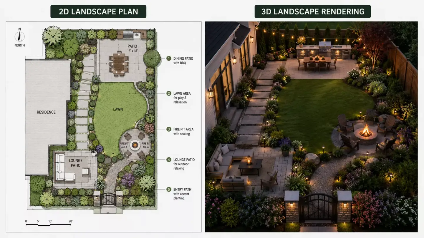
Landscape Rendering Compared With Landscape Design
Landscape design is the planning of the outdoor space, while landscape rendering is the visual communication of that design. Rendering does not replace design strategy, planting knowledge, circulation planning, or site analysis. It translates those decisions into an image that clients and stakeholders can understand.
| Term | Meaning | Output |
| Landscape design | Planning outdoor layout, planting, circulation, materials, and function | Design concept, drawings, plans |
| Landscape rendering | Visualizing the proposed design | Image, illustration, 3D view, or animation |
| Landscape architecture visualization | Broader visual communication for landscape projects | Renderings, diagrams, animations, VR, presentations |
A landscape designer may create the planting plan and circulation logic. A visualization artist may turn that plan into a photorealistic garden, park, or streetscape image. In some studios, the same team may handle both design and visualization, but the roles remain different.
This distinction matters for buyers. A beautiful render cannot fix a weak design, and a strong design may still need visualization to communicate its value. The best results happen when design decisions and rendering goals are aligned from the start.
Landscape Rendering Compared With Architectural RenderingLandscape Rendering Compared With Architectural Rendering
Landscape rendering focuses on outdoor spaces, while architectural rendering focuses on buildings and built structures. The two often overlap because real projects include both architecture and surrounding site design. Landscape rendering is strongest when planting, paths, terrain, lighting, and public use are central to the story.
A building exterior may look incomplete without a believable landscape. Trees, courtyards, sidewalks, driveways, and outdoor lighting can change how the architecture feels. When the building itself also needs strong visual presentation, 3D exterior rendering services can complement landscape visuals with facade detail, street presence, and architectural context.
The best project visuals often treat landscape and architecture as one environment. A real estate courtyard, resort entrance, or public plaza needs both building context and outdoor design clarity. Separating them too much can make the final presentation feel less credible.
Where Landscape Rendering Is UsedWhere Landscape Rendering Is Used
Landscape rendering is used anywhere an outdoor space needs to be explained, approved, sold, or improved before construction. It supports residential projects, real estate developments, public spaces, hospitality environments, commercial landscapes, and planning presentations. It is especially useful when planting, terrain, lighting, people, and seasonal change need to be understood together.
- Residential gardens and yards: show patios, pools, planting, decks, and outdoor living areas.
- Real estate developments: visualize amenities, courtyards, rooftops, gardens, and public areas.
- Parks and public spaces: communicate plazas, paths, playgrounds, seating, and community use.
- Urban design and streetscapes: show green streets, pedestrian areas, bike lanes, and public realm improvements.
- Hospitality and resorts: present pools, terraces, gardens, beach areas, and guest experience.
- Commercial landscapes: visualize office campuses, retail plazas, mixed-use developments, and outdoor dining.
- Planning and approval presentations: help stakeholders understand scale, access, planting, and environmental impact.
In real estate, outdoor amenities can be a major part of the project’s value. A courtyard, rooftop garden, pool deck, or public plaza may help buyers understand lifestyle and usability before construction is complete. For larger property campaigns, 3D rendering for real estate can connect landscape renderings with interior views, exterior images, floor plans, and presentation visuals.
3D Landscape Rendering Examples by Project Type3D Landscape Rendering Examples by Project Type
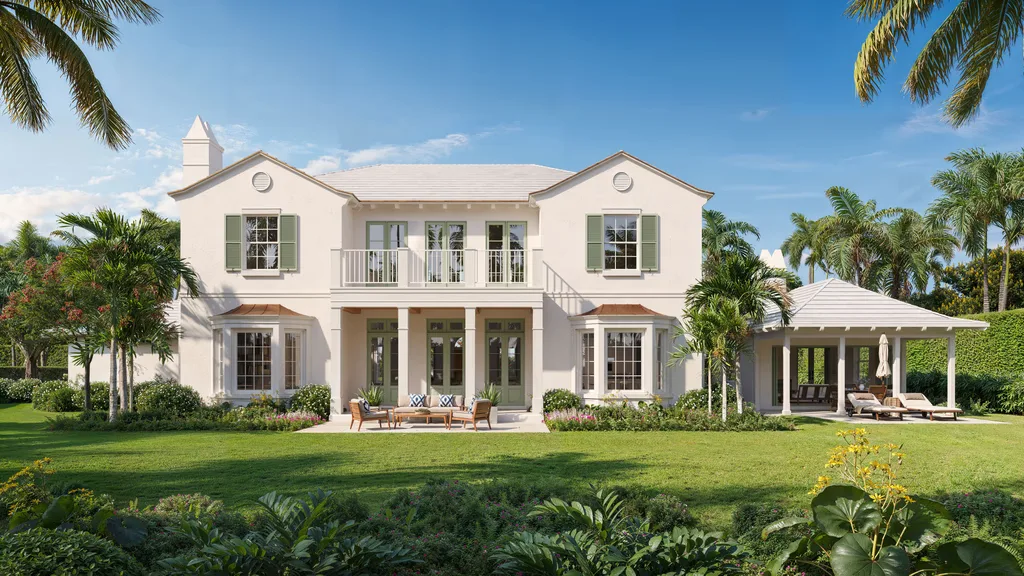
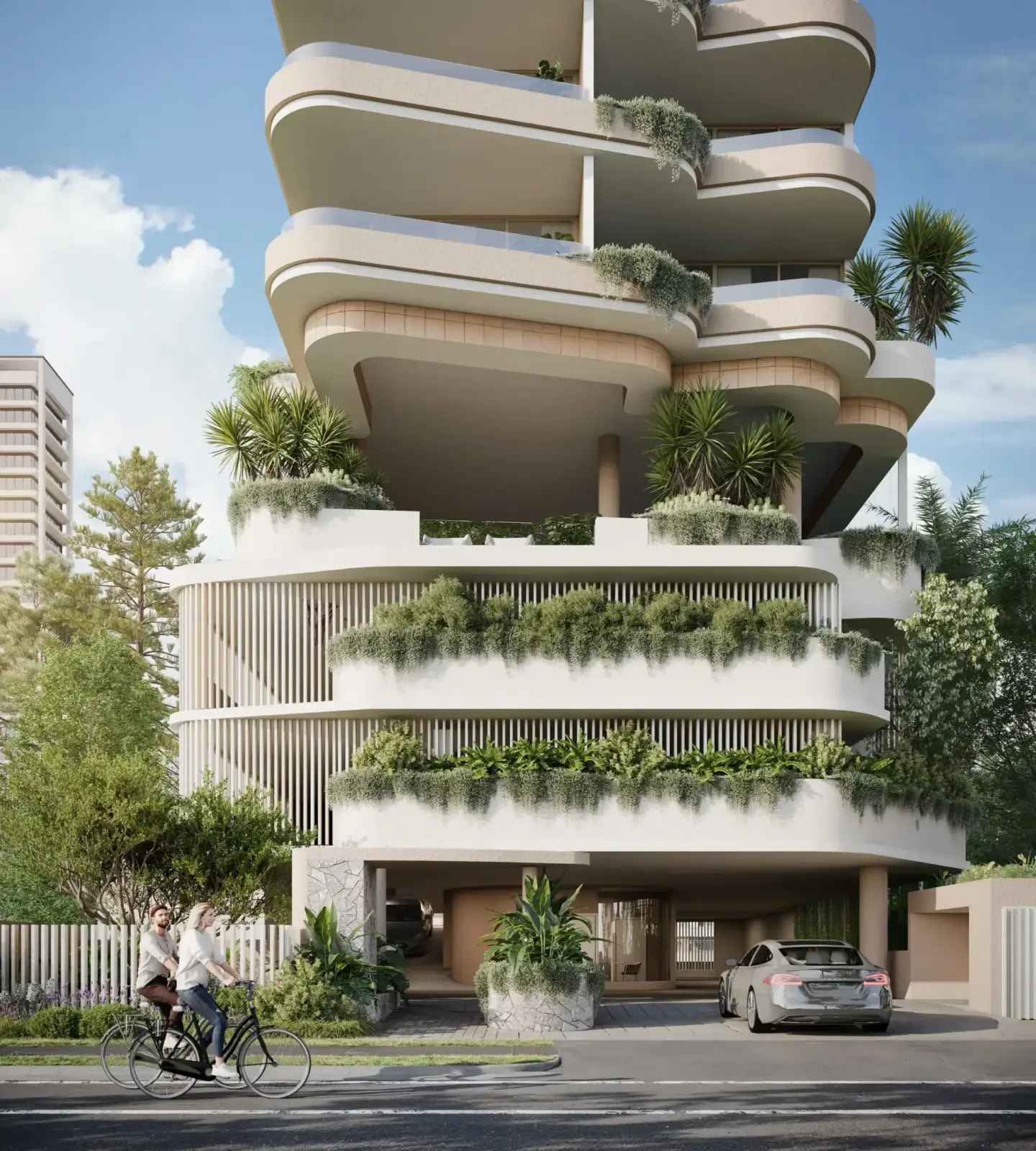
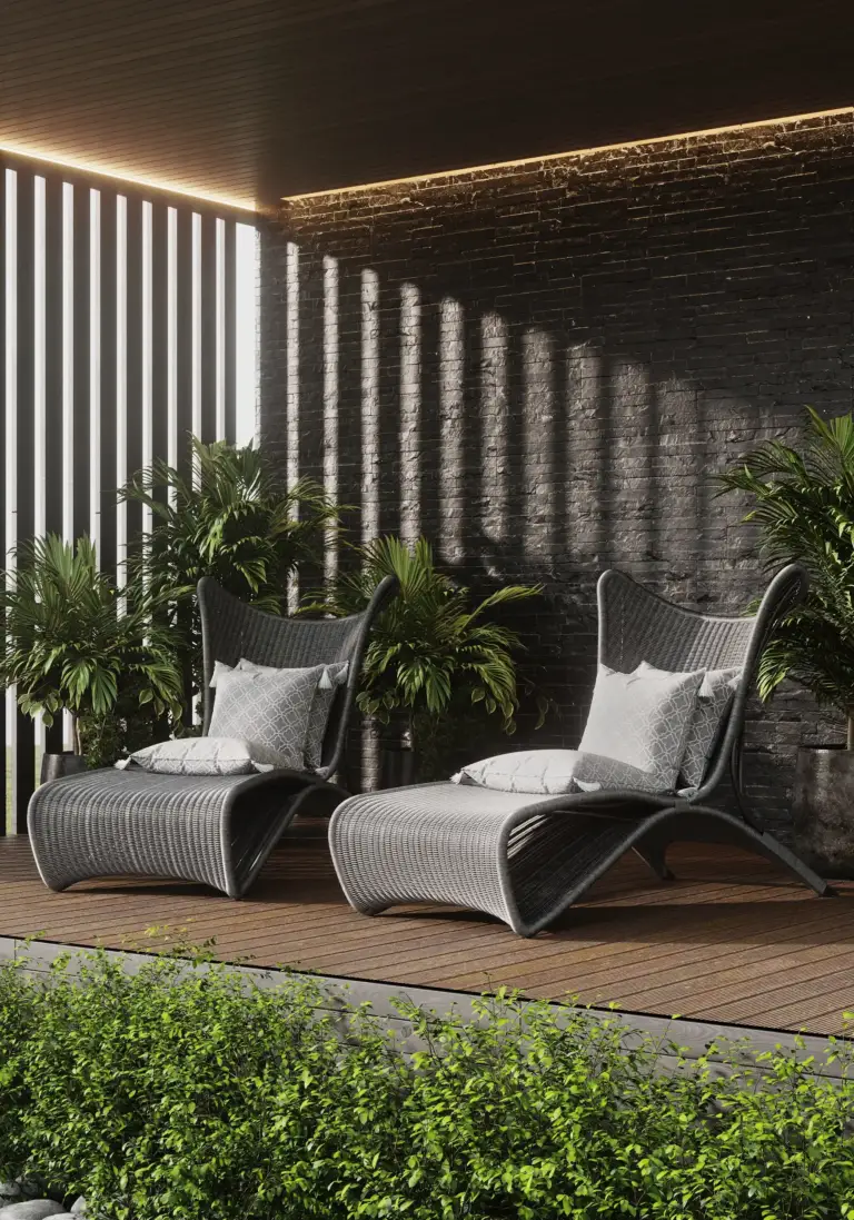
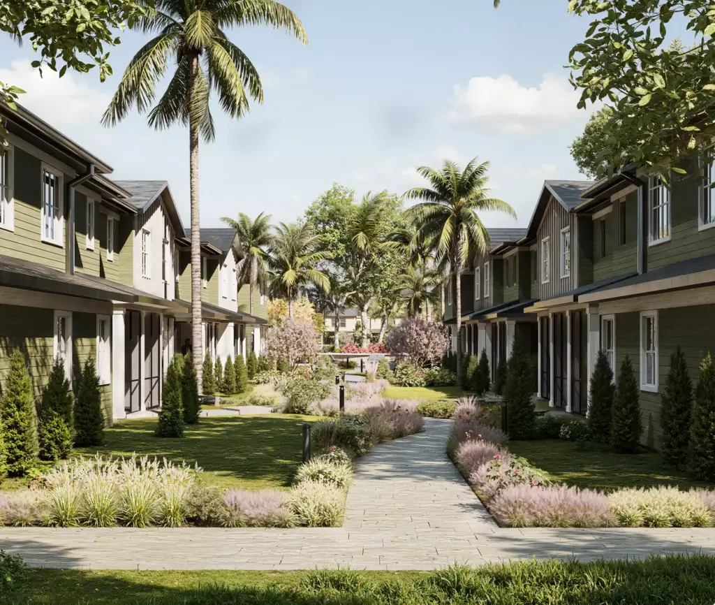
3D landscape rendering looks different depending on the project. A private garden, a rooftop amenity, a hospitality terrace, and a full residential masterplan each ask for different planting density, scale, and camera work. The examples below show how the same craft adapts across outdoor project types.
In our studio, the renders that land like these almost always start from the same two inputs: good drone photography of the real site and its exact map coordinates. The coordinates let us pull accurate terrain, slope, and surroundings instead of inventing them, and the drone frames show how the space actually reads from above. Landscape scenes are slow for this reason, because most of the work is the environment rather than one hero object, so when a deadline is squeezed too hard it is usually the surroundings that end up underdeveloped.
Private residential garden. A single photorealistic view is often enough to show planting, paving, and how the garden connects to the house.
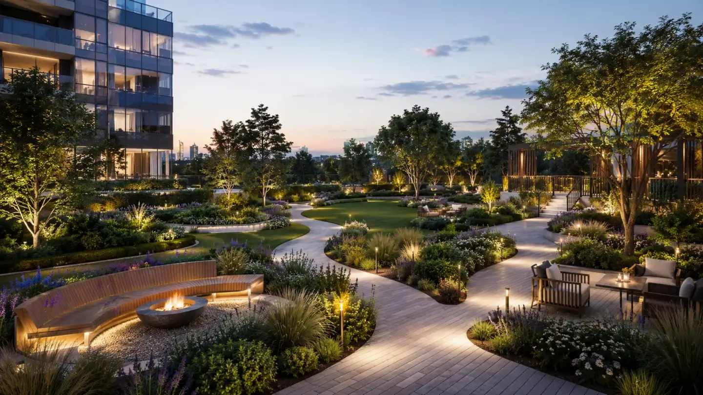
Rooftop and condo terrace amenity. Elevated outdoor spaces sell lifestyle, so the render has to place planting, seating, and skyline context together believably.
Hospitality terrace and lounge. Resort and restaurant projects lean on atmosphere, so evening light and materials matter more than a technical plan.
Residential development and masterplan. Larger sites usually need aerial and street-level views together so buyers and approval teams can read circulation, greenery, and density.
This is also where studio work separates from DIY tools. A homeowner can get a rough idea from a consumer app, but the same program used inside a full pipeline, alongside proper modeling, planting libraries, and lighting, produces a very different result; on its own, the DIY output usually stays mediocre. The hardest parts are the ones those tools handle worst: believable water in 3ds Max is still one of the toughest things to get right, and golden-hour, sunrise, or night scenes are far more demanding than a flat daytime render.
Benefits of Landscape RenderingBenefits of Landscape Rendering
Landscape rendering improves communication, reduces uncertainty, supports approvals, and helps clients see the value of an outdoor design. It turns technical planning into a visual form that is easier to review and discuss. This makes it useful for homeowners, developers, public agencies, architects, and landscape designers.
- Clearer client communication: non-technical viewers can understand the design without reading plans.
- Better design decisions: teams can evaluate planting, paths, views, lighting, and material choices earlier.
- Faster approvals: stakeholders can see the intended result more clearly.
- Stronger marketing: developers can show outdoor amenities before construction is complete.
- Reduced misunderstandings: visuals make scale, layout, and atmosphere easier to discuss.
- Seasonal planning: renderings can show how the landscape may look in different seasons or times of day.
The value is practical rather than guaranteed. A landscape render does not automatically win approval or sell a property, but it can make the conversation more concrete. When everyone can see the same outdoor space, feedback becomes more specific and useful.
Landscape Rendering Cost FactorsLandscape Rendering Cost Factors
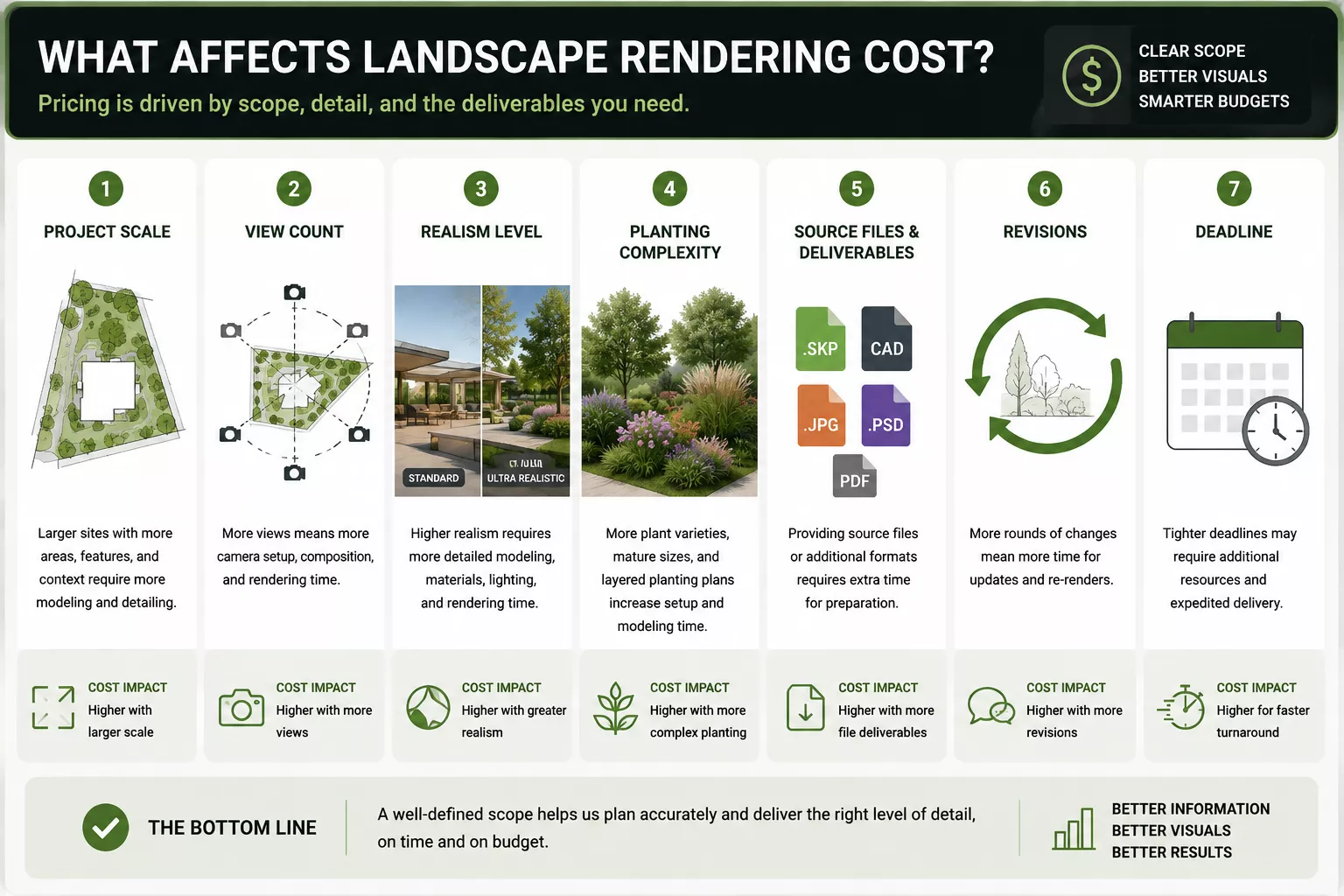
As a rough anchor, professional landscape rendering starts at around $30 to $39 per hour. A single photorealistic still is usually a few hours of work, while animations, large masterplans, and complex water or terrain move into multi-day production. The factors below are what actually move a quote up or down.
Landscape rendering cost depends on project size, detail level, realism, number of views, site complexity, available files, deadline, and whether the work is 2D, 3D, photorealistic, animated, or interactive. A simple conceptual view usually requires less production than a detailed photorealistic scene. Animation, large sites, complex terrain, and custom planting can add more work.
- Project scale and outdoor area size.
- Number of views or final images.
- 2D, 3D, photorealistic, animation, or interactive format.
- Complexity of planting, terrain, and hardscape.
- Quality of source files, CAD drawings, or 3D models.
- Need for people, vehicles, furniture, lighting, or seasonal effects.
- Revision rounds and deadlines.
- Commercial usage, presentation format, or marketing package requirements.
The best quote comes from a clear brief. Site plans, reference images, required views, desired style, and deadline help a studio estimate the work more accurately. If the project involves many stakeholders, revision rounds should also be planned before production begins.
Landscape Rendering Software
Landscape rendering can be created with design, modeling, rendering, and post-production tools. The software depends on whether the project needs a plan view, photorealistic image, animation, or interactive experience. Tools support the workflow, but accuracy, composition, planting logic, and material quality determine whether the final visual is useful.
- SketchUp: common for fast landscape and site modeling.
- Lumion: useful for vegetation, atmosphere, lighting, and quick architectural visualization.
- Twinmotion: real-time visualization for outdoor environments and presentations.
- 3ds Max: detailed professional modeling and visualization workflows.
- Blender: flexible modeling, rendering, and animation.
- V-Ray, Corona, or Chaos tools: photorealistic lighting, materials, and rendering.
- Unreal Engine: real-time, interactive, and VR-ready landscape visualization.
- Photoshop: post-production, color correction, entourage, and presentation refinement.
Some workflows are better for quick design studies. Others are better for final marketing visuals with realistic planting, lighting, water, and atmospheric depth. The right software should follow the project goal instead of driving the creative decision.
When to Use Landscape RenderingWhen to Use Landscape Rendering
Use landscape rendering when a plan, sketch, or technical drawing is not enough to communicate the outdoor experience. It is especially helpful when the audience needs to understand planting, scale, lighting, movement, or atmosphere before construction. The best format depends on the project goal, design stage, budget, and audience.
| Project Goal | Best Format |
| Show layout and planting zones | 2D landscape rendering |
| Explain scale and outdoor atmosphere | 3D landscape rendering |
| Market a development before completion | Photorealistic landscape rendering |
| Show movement through a park or resort | Landscape animation |
| Present a future outdoor area interactively | VR or real-time visualization |
| Compare design options quickly | Conceptual rendering |
| Support planning approval | 3D rendering with context and labels |
For small residential projects, one or two 3D views may be enough. For large developments, visuals often need to work across planning, marketing, and stakeholder review. In those cases, landscape rendering may be combined with diagrams, animation, aerial views, or interactive presentation.
Landscape Rendering Compared With Animation and Virtual ToursLandscape Rendering Compared With Animation and Virtual Tours
A static landscape render shows one carefully selected view, while animation shows movement through or around the outdoor space. A virtual tour or interactive experience gives users more control over where they look. The best choice depends on whether the viewer needs one strong image, a guided story, or independent exploration.
A still render works well for brochures, websites, approval boards, and investor slides. Animation is stronger when the route, arrival sequence, or outdoor experience needs to unfold over time. For projects where motion helps explain the landscape, 3D architectural animation services can turn outdoor environments into guided visual stories.
Interactive formats are useful when stakeholders need to explore areas at their own pace. A resort, park, or amenity deck may benefit from viewpoints that users can rotate and inspect. For immersive viewing, 360 panorama services can support look-around presentations of outdoor spaces and amenities.
How to Brief a Landscape Rendering StudioHow to Brief a Landscape Rendering Studio
A strong landscape rendering brief should explain the site, design intent, audience, required views, visual style, available files, and deadline. It should also clarify whether the output is for design review, real estate marketing, public approval, investor presentation, or construction planning. The more accurate the source information, the more accurate and useful the final rendering will be.
- Site plan, survey, CAD, BIM, or sketch files.
- Photos of the current site and surrounding context.
- Planting palette, hardscape materials, and furniture references.
- Required views, camera angles, and image quantity.
- Preferred season, time of day, and atmosphere.
- Target audience: client, buyer, investor, municipality, or public stakeholder.
- Visual reference examples.
- Branding, labels, annotations, or presentation requirements.
- Deadline and revision process.
A good brief should separate fixed design decisions from visual preferences. Site boundaries, grades, path locations, planting intent, and material choices usually need accuracy. Camera mood, season, entourage, and presentation style can often be adjusted to support the communication goal.
Quality Criteria for Landscape RenderingsQuality Criteria for Landscape Renderings
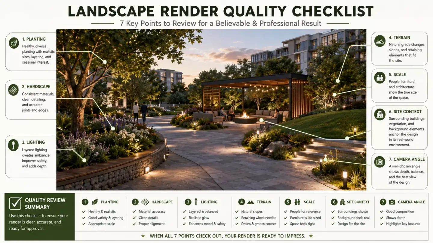
A good landscape rendering is accurate, readable, and believable. It should show the design clearly while respecting scale, plant behavior, terrain, lighting, material texture, and surrounding context. The image should help people evaluate the outdoor space rather than simply admire a decorative scene.
- Correct site layout, scale, and circulation.
- Believable planting size, density, and seasonal behavior.
- Realistic hardscape materials, paving, walls, and edges.
- Clear terrain, slopes, grading, and water behavior.
- Lighting that supports mood and shows important details.
- Useful context such as buildings, streets, or neighboring spaces.
- People, furniture, and vehicles used only when they clarify scale or use.
- Composition that makes the design easy to understand.
The most common weakness is treating plants as decoration instead of design elements. Trees, shrubs, lawns, and groundcover should match the space, climate, and intended atmosphere as closely as the brief allows. If a render hides circulation, exaggerates space, or ignores maintenance reality, it may mislead the decision process.
How to Choose the Right Landscape Rendering Format
Landscape rendering is a visual representation of an outdoor design, and it can be 2D, 3D, photorealistic, animated, or interactive. It helps explain planting, hardscape, lighting, terrain, scale, and atmosphere before construction begins. It supports design approval, stakeholder communication, real estate marketing, and construction planning.
The best format depends on the project goal and audience. A homeowner may need one realistic garden view, while a developer may need a full package of amenity renderings, aerial visuals, and presentation diagrams. A public project may need clear context, labels, circulation, and seasonal explanation.
Need to show an outdoor space before it is built? Share your site plan, sketches, CAD files, or reference images so the right format can be chosen for the project stage. If people need to understand an outdoor space before it exists, landscape rendering is one of the clearest ways to show the design.